

It’s that time of week again here at ScottKelby.com – it’s #HybridDaveTuesdays on #TravelTuesday – and this week, I’m going to answer a question I’ve been frequently asked, and then I’ll break it down a bit more!
Take a look at my posts on Instagram, and you’ll notice a theme: they’re all geotagged with the coordinates, along with a marker pin denoting the country right there at the top of the caption. It look’s a bit like this:-
The question I’m most often asked is not “How do you do it?” but “How do you remember?”
We live in a world where you can have GPS right there in your D-SLR, but mine doesn’t have that, so I have to have a system for remembering where I take photos, particularly those in the middle of nowhere or of something potentially nondescript in and of itself.
The first and primary thing I tend to do is, when using my D-SLR, I will also take the same photo with my iPhone with my geotagging turned on, thereby marking the shot on a map. It’s so simple, and it’s a really good reminder of what was where when I’ve been away on a trip taking hundreds of photos one after another. There are, of course, things which stand out in my memory, but those things which don’t can be easily tagged on a map right in my pocket.
Here’s an example, starting with the (festive, because it’s nearly Christmas) D-SLR shot:-
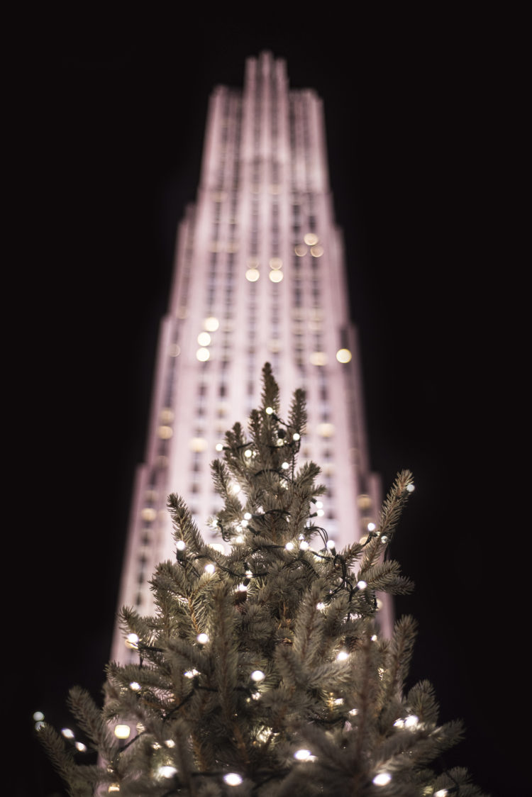
Of course, we know this is the Rockefeller Center tree, but suppose we didn’t. All we’d need to do is take a shot at the same place on the iPhone (or another brand, whichever, but preferably an iPhone!), and then go into the photo on the phone and swipe up:-
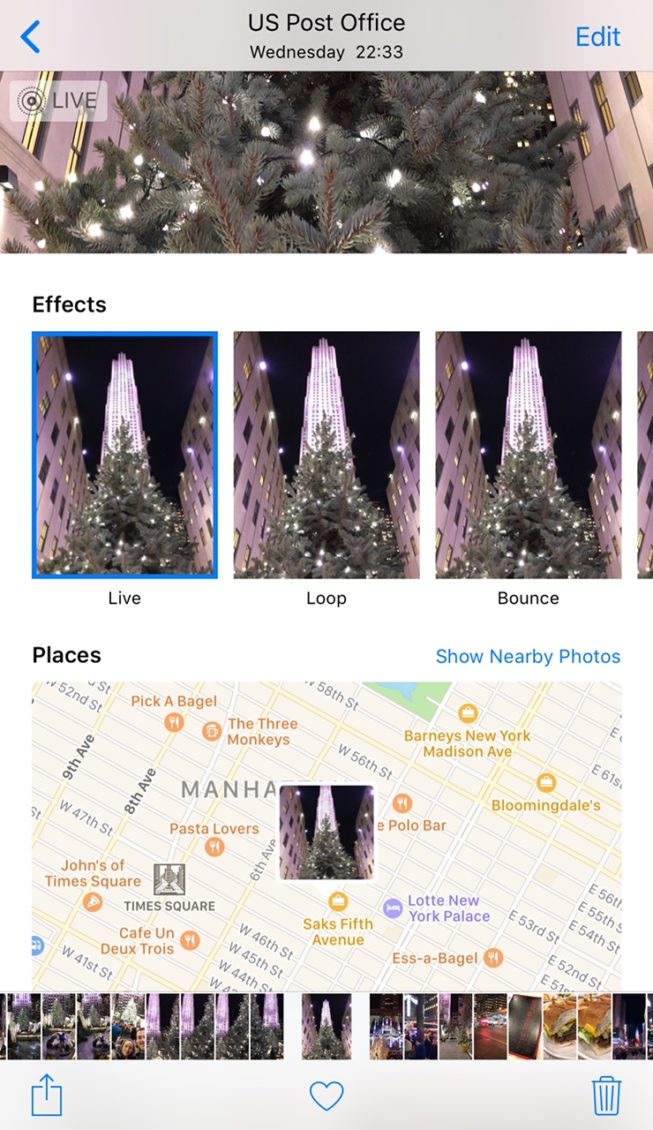
Right there, it’s sitting on the map, showing us the exact spot the photo was taken. It’s a GPS solution to tagging photos that we already have right there in our pockets.
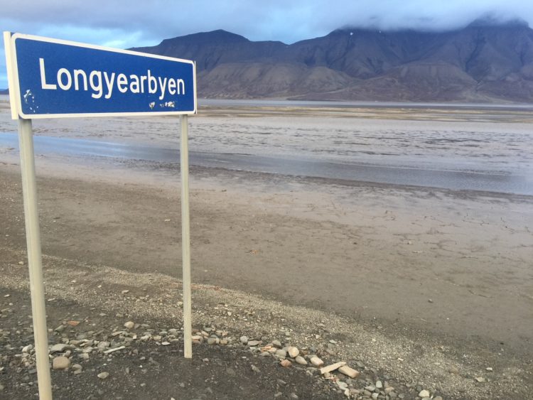
My second option is simpler still: once you’ve taken a photo, have a look around and see if there’s a sign you can shoot – a street name, a tourist sign, a shop name, anything that will jog your memory later would be great for getting a praise location for your photo.
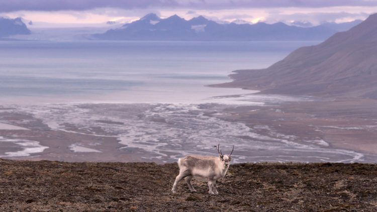
This is a Svalbard reindeer, the smallest reindeer sub-species. He’s looking down my lens from the edge of Longyearbyen on Spitsbergen. The glacial water flowing off into the sea through Adventdalen is pretty familiar, so as a reminder, in this instance, here’s what I did:-
Easy, right? Too easy to be telling you about? Well, it’s one of those things – it’s simple when you know what to do, but if you don’t do it, you’ll end up racking your brain trying to remember the name of a place you took a photo, so you’ll thank me when you start doing this!
I hope this was useful. Remember to check in here every week to see what other wisdom I have to impart from the world of travel photography and retouching, and you can reach out if you have any questions or topics for me by searching for me, Hybrid Dave, across social media :)
Much love
Dave

I’ve used Google Street View on numerous occasions to pinpoint my exact location after the fact. Of course, GSV doesn’t help if you were photographing in the middle of nowhere, but it sure does the trick when you were in a populated area or near an identifiable roadway.
I have been using mobile phone app Geotag Photos Lite/Pro for a couple of years. Synchronize time on your phone and camera and start. The mobile records your position and in then back home (internet connection necessary) simple desktop app adds coordinates to your pictures. Then it is compatible with Apperture, Lightroom etc. Simple and easy.